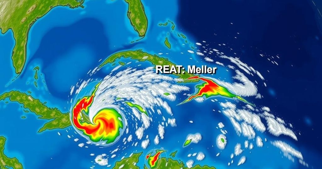
Meteorologists are tracking three areas of interest for potential tropical development in the Caribbean and North Atlantic, particularly focusing on the Southwestern Caribbean where a low-pressure system may evolve into a tropical depression this weekend. Other systems are producing rainfall across the Greater Antilles, while a low-pressure area near the Azores shows minimal chances for development. As the hurricane season nears its end, vigilance is advised.
This weekend, meteorologists are monitoring potential tropical developments in the tropics, particularly affecting the Caribbean and North Atlantic regions. Currently, three areas of interest have been identified. First, in the Southwestern Caribbean Sea, a broad low-pressure system is anticipated to develop over the next couple of days, with a possibility that a tropical depression may form. The system is likely to drift either northward or northwestward over the central to western Caribbean. Regardless of its development, significant rainfall is expected in areas from Nicaragua to northern Colombia. The prospects for development stand at a 10% chance within the next 48 hours and a 60% chance within the next week. Secondly, a trough of low pressure situated near Puerto Rico is generating widespread clouds and showers affecting Puerto Rico, the Dominican Republic, and adjacent islands. While the chances of this system developing into a tropical cyclone within the next few days remain low, localized heavy rains are probable across the northern Leeward Islands and extending through Puerto Rico to eastern Cuba. The formation chances here are similarly low, holding at 10% for both the next 48 hours and the week ahead. The GFS and ECMWF models suggest that these low-pressure systems may merge over the weekend, increasing the likelihood of tropical development by early next week. It is vital to note that the future track and intensity of these systems depend significantly on various atmospheric factors including the positioning of high-pressure ridges and the influence of an approaching cold front. Should a tropical depression materialize, the next name to be assigned will be Patty. Lastly, in the North Atlantic region, a non-tropical low-pressure area is producing thunderstorms approximately 550 miles from the Azores, but any evolution into a tropical cyclone is expected to occur slowly as the system progresses eastward. The chances for development remain low, estimated at 20% through the next week. As the hurricane season approaches its conclusion on November 30th, it is essential to stay informed about potential developments, especially as the weather patterns transition into the dryer season. Historical data reveals a rarity of hurricanes making landfall in Florida during November; only three have occurred since 1851. Highlighted historical hurricanes include the 1935 Miami Hurricane with winds at 100 mph; Hurricane Kate of 1985, which made landfall in Mexico Beach; and Hurricane Nicole in 2022 affecting Vero Beach with winds of 75 mph.
This article provides a detailed update on three potential tropical weather systems that are being monitored in the Caribbean Sea and North Atlantic as of October 31, 2024. The focus is on potential tropical cyclone development in the Southwestern Caribbean and the effects of other low-pressure systems around Puerto Rico and the Greater Antilles. It also discusses the historical perspective regarding hurricanes impacting Florida in November, a period generally characterized by decreased hurricane activity. Understanding these weather patterns helps residents prepare adequately for possible changes, especially as the hurricane season approaches its end.
In summary, meteorological experts are closely observing several areas of low pressure in the Caribbean that may develop into tropical systems over the weekend or early next week. While the chances for immediate formation appear low to medium, the potential for significant rainfall and localized hazards remains high. Historical context highlights the rarity of hurricanes impacting Florida in November, reminding residents of the unpredictable nature of tropical weather during this transitional period.
Original Source: www.fox4now.com


